OceanOpsAI Introduction
A predictive web platform combining high-resolution weather data, wave spectra analysis, vessel dynamics, and operational workflows to optimize offshore decision-making.

Maximize Operability
Aim to increase offshore operability by 10%–15% through precise decision support and vessel motion predictions.
Smarter Offshore Decisions
High-dimension wave spectra, vessel dynamics, operational sequences, and limits — all integrated into one platform to deliver clear, data-driven decisions for every offshore operation.
What OceanOpsAI Delivers
Comprehensive features for safer and more efficient offshore installations and operations.
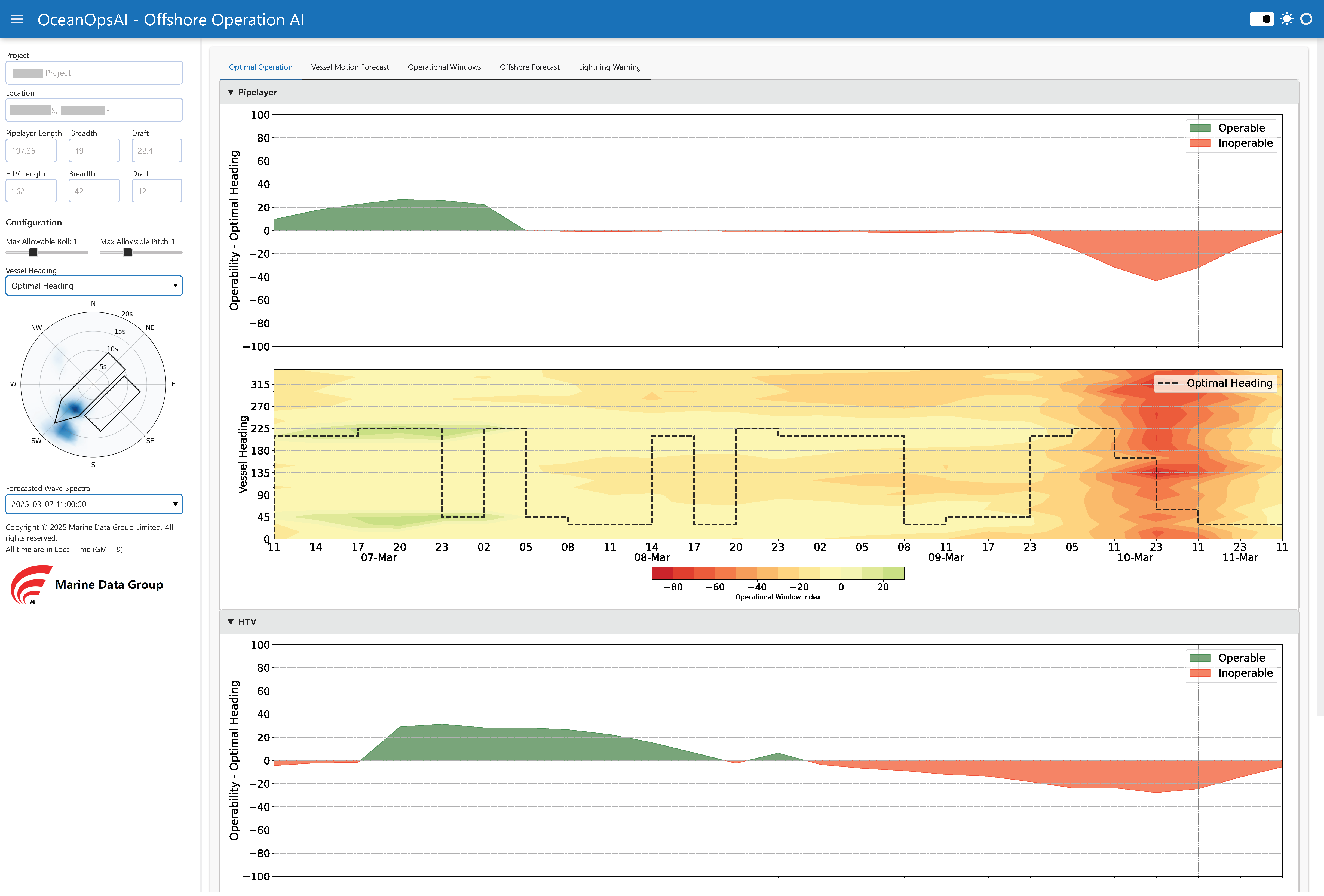
1. Optimal Vessel Heading Guidance
Recommends headings that minimize vessel motions, improving workability and operational efficiency in offshore conditions.
2. Vessel Motion Forecasts
Predicts vessel motions, including roll, pitch, and accelerations, as well as operational responses, supporting safe and effective offshore operations.
3. Integrated Operational Windows
Predicts optimal operational windows over the next 10 days, helping minimize downtime and operational risk.
4. Weather Forecasts and Alerts
Delivers accurate, real-time weather forecasts and alerts to mitigate risks from storms, high winds, or rough seas.
5. Comprehensive Metocean Reports
Provides detailed wave, wind, and current data for benchmarking project progress.
How OceanOpsAI works
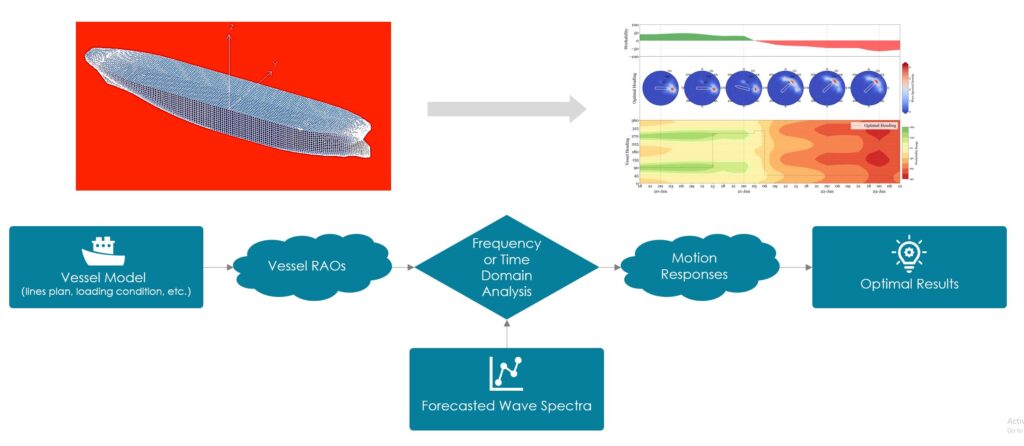

2D Wave Spectra Forecast
OceanOpsAI uses two-dimensional wave spectra to capture the full range of sea states, including wave height, period, and directionality. This allows for a precise representation of the ocean environment in which vessels operate.

Full Vessel Model
Integrates detailed real vessel characteristics, including hull geometry, loading condition, stability to reflect the true hydrodynamic behavior of the ship.

Real-Time Response Simulations
Merges wave data and vessel dynamics to simulate motions, accelerations, and loads in real time, enabling operators to anticipate vessel performance, optimize operational decisions, and enhance safety in dynamic sea conditions.
Launch OceanOpsAI
Start using OceanOpsAI with only 3 inputs.
1. Project Location
The latitude and longitude of your project.
2. Vessel Info
Vessel geometry and loading condition .
3. Operational limit
Roll, Pitch limits or any other limit
Simply send your 3 inputs to info@marinedatagroup.com, and get your all-in-one offshore operations platform online within a week to:
- Unlock actionable offshore insights
- Maximize vessel workability
- Access high-resolution weather forecasts
- Predict operational windows in sequence
- Get real-time risk alerts and warnings